


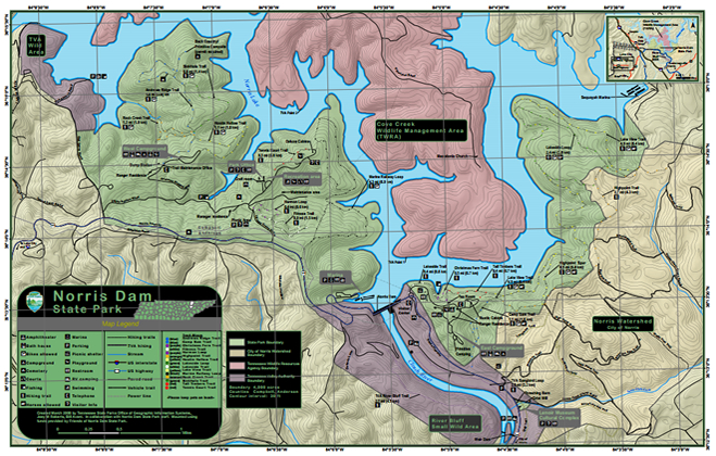
Norris Dam State Park makes a perfect stop for your Tennessee vacation and offers plenty of options for nature lovers! Be sure to check out the Norris Dam State Park map for information on all the available hiking trails, camping sites, picnic and recreation areas, marina, visitors center and more! The map is available for download below.
Lakeside Trail

View of the entrance to Lakeside Trail across from Norris Dam. This trail is 0.4 mi (0.6 km) with an easy loop of .88 miles. Parking is located at the entrance of this trail as well as at the visitors center for Norris Dam. The area is great for photographers and has plenty of outdoor tables for a quick picnic or lunch.

Lakeside Trail is not only a great place for a small easy nature hike but is also great for bike rides.

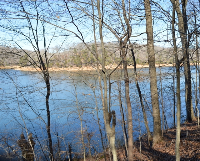
Lakeside Trail offers views of Norris Lake.

View of Norris Dam Marina from entrance at Lakeside Trail.
Norris Dam State Park Map
Directions
To get to Lakeside Trail from Norris Freeway exit drive via TN-71 N/TN-71 Scenic N/US-441 N/US-441 Scenic N/Norris Fwy only 7.4 miles and 13 minutes. If you are coming from Norris Dam State Park take Norris Freeway across Norris Dam and park at the visitors center.
Norris Dam State Park
125 Village Green Circle
Lake City, TN 37769
Telephone: (865) 494-7461
Website: www.norrisdamstatepark.org
Park Activities: boating, cabin rentals, camping, fishing, hiking trails, marina, picnic facilities, swimming, summer programs, national trail day, wildflower hikes, fall color boat cruises, junior ranger camp, pickin in the park, public lands day
Have a question or comment about Norris Lake? Feel free to share your thoughts and comments!


